okay, i'm pretty unhappy with the way this turned out... grr... but trust me, it's much bigger and prettier and higher resolution in person.
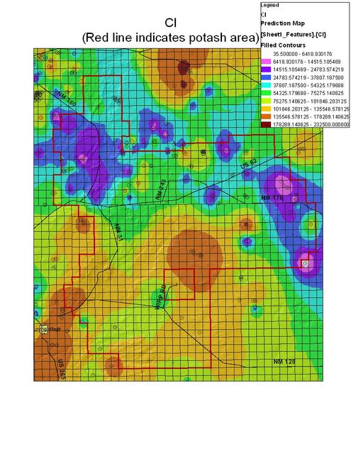
anyway, this is an area of southeast new mexico (carlsbad is just on the other side of the bottom left corner), and, using data taken from well samples from this portion of the state, this is the average predicted concentration of chlorine in the ground water. neat, huh? i MADE this.
the colors are different concentrations of chlorine, the grid squares are the township/range that the mining companies use, and the thick red line is the border of the potash mining area. the little black lines are roads (that are actually labeled, ooooooo!), and you can sort of see the village loving down there in the corner. oh, and if you were actually looking at this picture before i internet-ized it, you could see the new mexico hillshade on there, too. that is really cool. it actually shows the hills and mountains and stuff with little shadows on the map. this area is pretty flat, so it's not as noticeable as it would be for other parts of the state, like say, los alamos, but still, it's cool.
don't ask me what this has to do with mechanical engineering.
No comments:
Post a Comment